Please show your support of Waihekepedia by adding a link to us from your web site. Waihekepedia T Shirts now available at the Ostend Market
Difference between revisions of "Hekerua Bay"
Jump to navigation
Jump to search

m |
Countrymike (talk | contribs) m (tidying up a bit...) |
||
| Line 1: | Line 1: | ||
Hekerua Bay is one of the more secluded of Waiheke's northern bays, being only accessible by foot or boat. A track to it can be found at adjacent [[Sandy Bay]], or walkers can access it down the leafy | Hekerua Bay is one of the more secluded of Waiheke's northern bays, being only accessible by foot or boat. A track to it can be found at adjacent [[Sandy Bay]], or walkers can access it down the leafy | ||
paper road known as Te Aroha Ave. There is also a sealed path called the Zig Zag path down to the beach from the cnr of Queens Drive and Goodwin Place. The top of the path is easily identifiable by the letterboxes. | paper road known as Te Aroha Ave. There is also a sealed path called the Zig Zag path down to the beach from the cnr of Queens Drive and Goodwin Place. The top of the path is easily identifiable by the letterboxes. | ||
| − | |||
| − | |||
| − | |||
| − | |||
| − | |||
| − | |||
| − | |||
| − | |||
| − | |||
| − | |||
| − | |||
| − | |||
| − | |||
| − | |||
[[Image:Hekerua Bay.JPG|right|Hekerua Bay 2007]] | [[Image:Hekerua Bay.JPG|right|Hekerua Bay 2007]] | ||
| − | |||
| − | |||
| − | |||
| − | |||
| − | |||
| − | |||
| − | |||
| − | |||
| − | |||
| − | |||
| − | |||
| − | |||
| − | |||
| − | |||
| − | |||
| − | |||
| − | |||
| − | |||
| − | |||
| − | |||
| − | |||
| − | |||
| − | |||
| − | |||
| − | |||
| − | |||
| − | |||
| − | |||
| − | |||
| − | |||
| − | |||
| − | |||
| − | |||
| − | |||
| − | |||
| Line 58: | Line 9: | ||
| + | <br style="clear:both;" /> | ||
| + | <gmap lat="-36.780589" long="175.025597" zoom="2" width="400" height="300">Map Title</gmap> | ||
| − | + | [[Category:Beaches]] | |
| − | |||
| − | |||
| − | |||
| − | |||
| − | |||
| − | |||
| − | |||
| − | |||
| − | |||
| − | |||
| − | |||
| − | |||
| − | |||
| − | |||
| − | |||
| − | |||
| − | |||
| − | |||
| − | |||
| − | |||
| − | |||
| − | |||
| − | |||
| − | |||
| − | |||
| − | |||
| − | |||
| − | |||
| − | |||
| − | |||
Revision as of 03:33, 24 September 2007
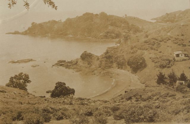
Hekerua Bay is one of the more secluded of Waiheke's northern bays, being only accessible by foot or boat. A track to it can be found at adjacent Sandy Bay, or walkers can access it down the leafy paper road known as Te Aroha Ave. There is also a sealed path called the Zig Zag path down to the beach from the cnr of Queens Drive and Goodwin Place. The top of the path is easily identifiable by the letterboxes.


Hekerua Bay 1930s
<gmap lat="-36.780589" long="175.025597" zoom="2" width="400" height="300">Map Title</gmap>