Please show your support of Waihekepedia by adding a link to us from your web site. Waihekepedia T Shirts now available at the Ostend Market
Difference between revisions of "Sandy Bay"
Jump to navigation
Jump to search
| (One intermediate revision by the same user not shown) | |||
| Line 7: | Line 7: | ||
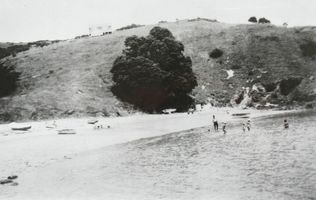
|[[Image:Sandy Bay 1950s.JPG|frame|left|Sandy Bay 1950s]] | |[[Image:Sandy Bay 1950s.JPG|frame|left|Sandy Bay 1950s]] | ||
|- | |- | ||
| − | | | + | | Maps location of Sandy Bay {{map|lat=-36.77973|lon=175.028729|zoom=16|width=400|height=300|type=hybrid|title=Sandy Bay}} |
|} | |} | ||
[[Category:Beaches]] | [[Category:Beaches]] | ||
[[Category:Maps]] | [[Category:Maps]] | ||
Latest revision as of 09:38, 7 October 2014
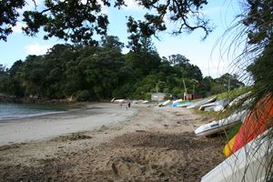
A north-west facing bay, and the only one on the northern side of the island with a concrete boat ramp. From December 24th to February 6th and over Easter Weekend, the ramp is closed between 12 noon and 6pm. There is a public toilet at Sandy Bay.
| Maps location of Sandy Bay
|

