Please show your support of Waihekepedia by adding a link to us from your web site. Waihekepedia T Shirts now available at the Ostend Market
Difference between revisions of "Okahuiti Estuary"
Jump to navigation
Jump to search
Hackademic (talk | contribs) |
m (format) |
||
| (2 intermediate revisions by 2 users not shown) | |||
| Line 1: | Line 1: | ||
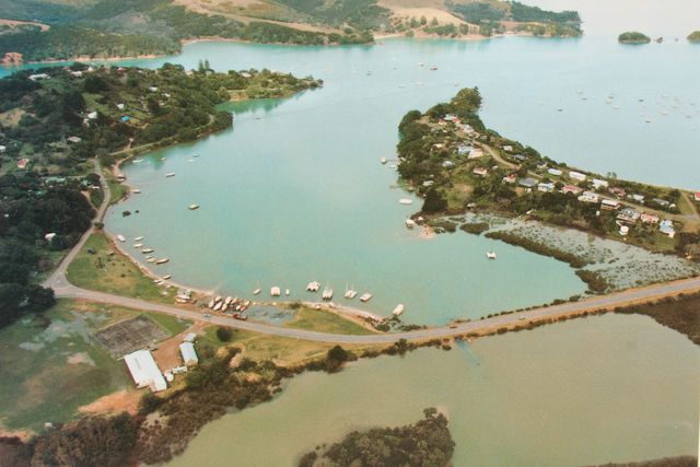
| − | The Okahuiti Estuary forms the upper reaches of Putiki Bay and sits nestled to the northern side of the island's famous causeway linking [[Surfdale]] to [[Ostend]]. | + | The '''Okahuiti Estuary''' forms the upper reaches of [[Putiki Bay]] and sits nestled to the northern side of the island's famous causeway linking [[Surfdale]] to [[Ostend]]. |
| + | |||
| + | [[Image:Causeway.JPG|frame|left|The Causeway]] | ||
Latest revision as of 07:47, 19 September 2007
The Okahuiti Estuary forms the upper reaches of Putiki Bay and sits nestled to the northern side of the island's famous causeway linking Surfdale to Ostend.
