Please show your support of Waihekepedia by adding a link to us from your web site. Waihekepedia T Shirts now available at the Ostend Market
Difference between revisions of "Rangitoto Island"
Jump to navigation
Jump to search
m (Text replacement - "\<googlemap(.*)lat="(.*)" lon="(.*)" zoom="(.*)" width="(.*)" height="(.*)"\>(.*)\<.googlemap\>" to "{{map|lat=$2|lon=$3|zoom=$4|width=$5|height=$6|title=$7}}") |
|||
| Line 7: | Line 7: | ||
| − | + | {{map|lat=-36.80|lon=174.9|zoom=11|width=300|height=200|title=-36.782,174.85,Rangitoto Island}} | |
[[Category:Stubs]] | [[Category:Stubs]] | ||
[[Category:Islands]] | [[Category:Islands]] | ||
[[Category:Tourist Attractions]] | [[Category:Tourist Attractions]] | ||
[[Category:Maps]] | [[Category:Maps]] | ||
Latest revision as of 10:13, 7 October 2014

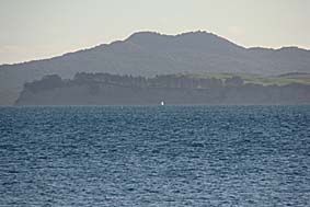
An icon of Auckland and the gulf.
http://en.wikipedia.org/wiki/Rangitoto Rangitoto Island] is a volcanic island some 600 years old.
The Rangitoto Island Scenic Reserve is worthwhile visiting.
There is a ferry service by Fullers Group Limited from Auckland going 3-4 times a day taking some 25 minutes. In the summer there are two weekend sailings available Saturdays and Sundays from Waiheke Island's Matiatia wharf.
It is also possible to reach the island by sea kayak or boat.