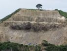
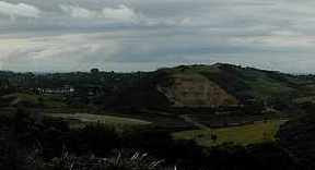
The Stony Ridge / Waiheke quarry is situated on a hill overlooking the intersection of Onetangi, Ostend and O'Brien Roads. This quarry produces base course crushed rock material for use in road construction and the building industry in Waiheke.
The stone has a orange/brown colour and the decades of use all over the island make them a unique icon of Waiheke. Although the majority of roads on Waiheke are now sealed, there are still a number of roads that use this stone as the primary surface and all roads on Waiheke contain at least some stone from this quarry.
Due to its aesthetically pleasing look ( as compared to other quarried stone) the stone can also be widely seen and is commonly used in walls, gardens, driveways and even some building construction.
The quarry has been owned and operated by Phil and Lila Mathewson since 1995 and was purchased by Central Quarries Ltd in 2005. Central Quarries is part of the ever expanding Central Topsoil and Landscaping Supplies group owned by Wayne Rissetto.
Phone: 09 372 7071
Fax: 09 372 7071
Operating Hours:
Monday - Friday: 7.00am - 4.30pm
Saturday: 7.30am - 12pm


Loading map...
{"minzoom":10,"maxzoom":15,"mappingservice":"leaflet","width":"400px","height":"300px","centre":false,"title":"","label":"","icon":"","lines":[],"polygons":[],"circles":[],"rectangles":[],"copycoords":false,"static":false,"zoom":17,"defzoom":14,"layers":["osm-mapnik","osm-cyclemap","bing-hybrid"],"image layers":[],"overlays":[],"resizable":true,"fullscreen":false,"scrollwheelzoom":true,"cluster":false,"clustermaxzoom":20,"clusterzoomonclick":true,"clustermaxradius":80,"clusterspiderfy":true,"geojson":"","clicktarget":"","imageLayers":[],"locations":[{"text":"","title":"","link":"","lat":-36.801416,"lon":175.060369,"icon":""}],"imageoverlays":null}
Loading map...
{"type":"ROADMAP","minzoom":10,"maxzoom":15,"types":["ROADMAP","SATELLITE","HYBRID","TERRAIN"],"mappingservice":"googlemaps","width":"400px","height":"300px","centre":false,"title":"","label":"","icon":"","lines":[],"polygons":[],"circles":[],"rectangles":[],"copycoords":false,"static":false,"visitedicon":"","wmsoverlay":false,"zoom":17,"layers":[],"controls":["pan","zoom","type","scale","streetview","rotate"],"zoomstyle":"DEFAULT","typestyle":"DEFAULT","autoinfowindows":false,"resizable":true,"kmlrezoom":false,"poi":true,"cluster":false,"clustergridsize":60,"clustermaxzoom":20,"clusterzoomonclick":true,"clusteraveragecenter":true,"clusterminsize":2,"imageoverlays":[],"kml":[],"gkml":[],"searchmarkers":"","fullscreen":false,"scrollwheelzoom":false,"locations":[{"text":"","title":"","link":"","lat":-36.801416,"lon":175.060369,"icon":""}]}

