Please show your support of Waihekepedia by adding a link to us from your web site. Waihekepedia T Shirts now available at the Ostend Market
Difference between revisions of "Enclosure Bay"
m (Text replacement - "\<googlemap(.*)lat="(.*)" lon="(.*)" zoom="(.*)" width="(.*)" height="(.*)" type="(.*)"\>(.*)\<.googlemap\>" to "{{map|lat=$2|lon=$3|zoom=$4|width=$5|height=$6|type=$7|title=$8}}") |
|||
| (48 intermediate revisions by 5 users not shown) | |||
| Line 1: | Line 1: | ||
| − | Enclosure Bay | + | Enclosure Bay, situated between [[Oneroa]] and [[Palm Beach]] on the northern side of Waiheke Island |
| − | + | is unique as its protected by two reef systems from the northerlies, not open to the sea as are most other bays on this side of the island. This leads to a very safe place for children to swim ..in a natural swimming pool that gets flushed twice a day. | |
| − | Our family has a long connection with Enclosure Bay.. the fifth generation now enjoys it. My Great Grand mother Dorothy Nugent bought property there back in the 20s when the second colonization of the island by colonial types happened. | + | One Waihekepedia editor's story: "Enclosure Bay is slightly off the beaten track.. as a kid the bus would drop us off right outside our door, now we get to walk down the hill from Popes corner. We used to traverse the climb every day for milk etc when the shop was there. Now we jump in the car and pop over to the supermarket. |
| − | + | ||
| + | "Our family has a long connection with Enclosure Bay.. the fifth generation now enjoys it. My Great Grand mother Dorothy Nugent bought property there back in the 20s when the second colonization of the island by colonial types happened. | ||
| + | |||
| + | [http://enclosurebay.blogspot.com/ click to see the Enclosure Bay site] | ||
| + | {| | ||
| + | |- | ||
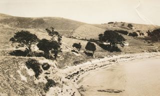
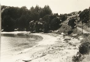
| + | |[[Image:Waiheke historical (144) -320x200-.JPG|frame|left|Early photo of Enclosure Bay taken 1920s]][[Image:Waiheke historical (140) -320x200-.JPG|frame|left|Photo of Enclosure Bay taken late 50s]] | ||
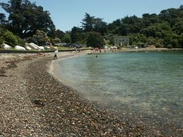
| + | |[[Image:Enclosure Bay-320x200-.jpg|frame|left|And Enclosure Bay 2005]] | ||
| + | |- | ||
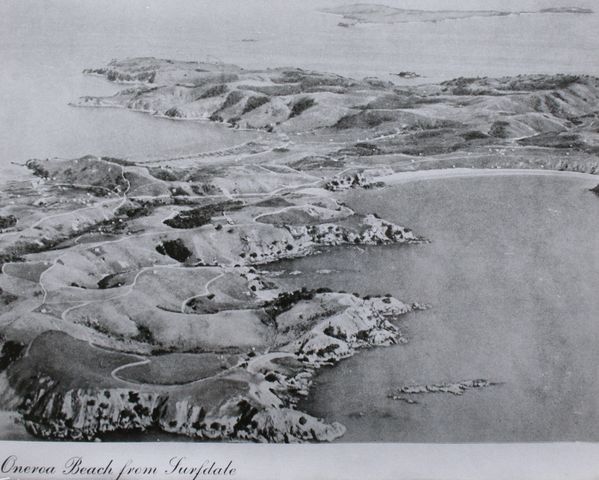
| + | |[[Image:Oneroa beach surfdale 1920 -640x480-.JPG|frame|left|Enclosure Bay is at the bottom of this aerial photo taken around 1920, part of the advertising to sell land at that time]] | ||
| + | |- | ||
| + | |Maybe the first ever video of Enclosure Bay taken in 1957 | ||
| + | |- | ||
| + | |<youtube>YAC_HHrayn8</youtube> | ||
| + | |- | ||
| + | |Google maps, Enclosure Bay {{map|lat=-36.777238|lon=175.03536|zoom=16|width=400|height=300|type=hybrid|title=Enclosure Bay}} | ||
| + | |} | ||
| + | [[Category:Beaches]] | ||
| + | [[Category:Maps]] | ||
| + | [[Category:History]] | ||
Latest revision as of 08:56, 7 October 2014
Enclosure Bay, situated between Oneroa and Palm Beach on the northern side of Waiheke Island is unique as its protected by two reef systems from the northerlies, not open to the sea as are most other bays on this side of the island. This leads to a very safe place for children to swim ..in a natural swimming pool that gets flushed twice a day.
One Waihekepedia editor's story: "Enclosure Bay is slightly off the beaten track.. as a kid the bus would drop us off right outside our door, now we get to walk down the hill from Popes corner. We used to traverse the climb every day for milk etc when the shop was there. Now we jump in the car and pop over to the supermarket.
"Our family has a long connection with Enclosure Bay.. the fifth generation now enjoys it. My Great Grand mother Dorothy Nugent bought property there back in the 20s when the second colonization of the island by colonial types happened.
click to see the Enclosure Bay site
| Maybe the first ever video of Enclosure Bay taken in 1957 | |
| Google maps, Enclosure Bay
|


